The maps below show Pancha Village in 2005 and 2015. Summarise the information by selecting and reporting the main features, and make comparisons where relevant.
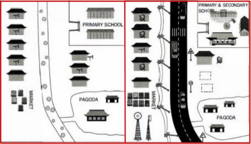
The map describes the information about the development of facilities in the small rural area named Panca Village facilities between 2005 and 2015.
It is noticeable that there are many significant differences from those facilities that had been constructed from 2005 to 2015.
In 2015, the Pancha Village had only a small pathway that connects to some buildings such as Pagoda, Market, and Primary school. The path had much stone inside the road so that this could not be accessed by mode of transportations. In addition, this village did not have electrical facilities.
On the other hand, the asphalt road with line marker and signs was constructed over ten years later, and the electricity cable was located alongside the highway. A tower was built to support electrical facilities in this village. Consequently, the town has been accessed by cars and trucks since 2015. In addition, the secondary school was built near to the primary school. Last but not least, the pagoda building was expanded by constructing more buildings from two to three.
Follow Us on IELTSDATA Twitter
Also, Read The chart below shows the places visited by different people living in Canada.