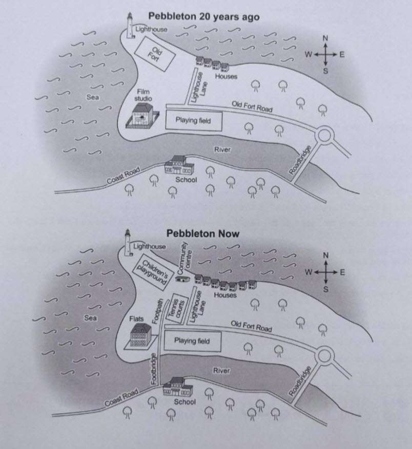
The maps below show Pebbleton 20 years ago and today. Summarise the information by selecting and reporting the main features, and make comparisons where relevant.
Sample Answer of The Maps Below Show Pebbleton 20 Years Ago and Today
The given map illustrates the significant changes of Pembleton island over the 20 years.
Overall, remarkable alterations have occurred over the given years. The island turned out to be more for residential purposes and introduced pedestrian-friendly amenities.
The main change that stands out is that the coastal fort, which is located in the western part of the city, is replaced into a children’s playground with installing a new community center near to it. The number of houses has been increased, and a new pedestrian bridge has developed from the school to Pembleton.
The film studio was refurbished into a residential flat and a newly designed footpath running in between the flat and revenue court. The playing field, which is located in the southern part, and the light hose situated in the western part remain untouched.
Follow Us on IELTSDATA Twitter
Also, Read You Live in a Block of Flats GT Writing
The Graph Below Shows the Amount of Uk Investments in Clean Energy from 2008 to 2015
